Excessive Rainfall Discussion
NWS Weather Prediction Center College Park MD
1153 AM EDT Fri Jul 3 2026
Day 1
Valid 16Z Fri Jul 03 2026 - 12Z Sat Jul 04 2026
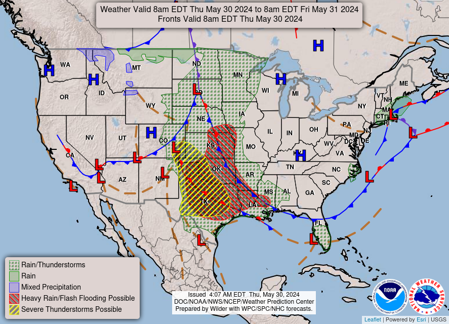
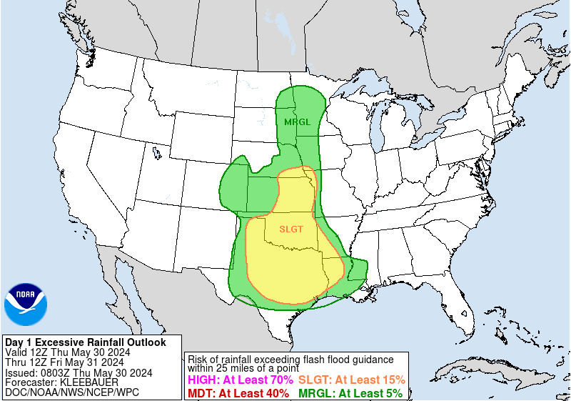
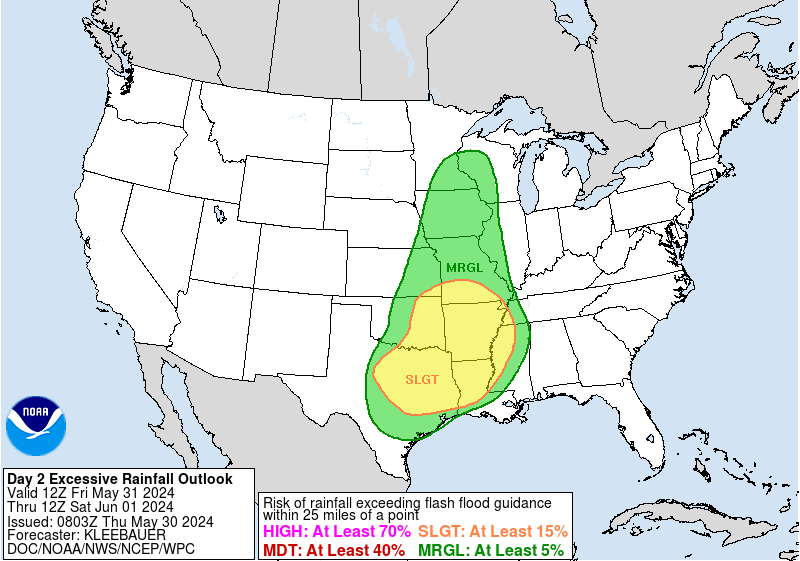
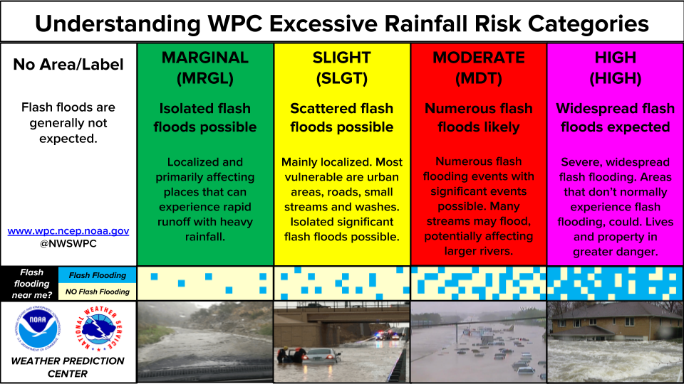
...THERE IS A SLIGHT RISK OF EXCESSIVE RAINFALL FOR MUCH OF IOWA
AND EASTERN NEBRASKA...
...Northern/Central Plains to the Midwest...
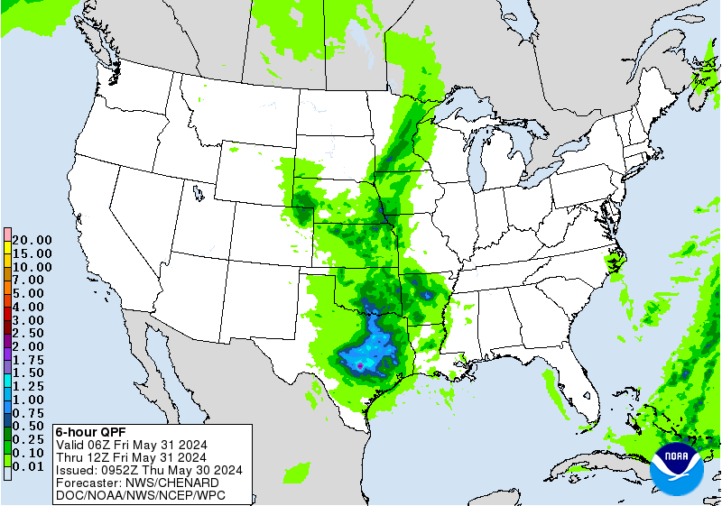
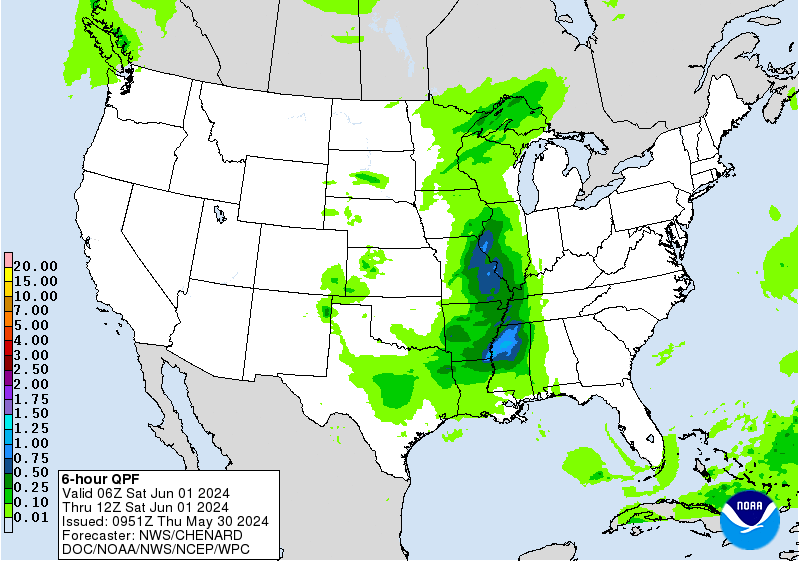
16Z Update: Heavy rainfall this morning way over-performed in
areas centered over Central IA within proximity of a surface trough
analyzed overhead. The setup across the Plains remains a bit
complex with the passage of multiple shortwaves and the undulation
of formidable theta_E/instability maxima being advected into the
region on the lead of a broad trough to the west. Models continue
to struggle in this setup which is customary with more weakly
forced environments dominating the synoptic and mesoscale
convective scheme. The trend the past several days has been for
heavier precip to shift south of where guidance is suggesting, and
this is likely trending in that direction just based on
observational tendencies the past 24 hrs. This would also correlate
well with the ML outputs remaining a solid 50-100 miles south in
their depictions of where the heaviest precip is forecast (albeit
still missing the mark on magnitude by a considerable margin).
Considering the upstream shortwave propagation into Central High
Plains today, carrying eastward through the period and beyond, the
forecast is likely to be correct in cell initiation across central
and eastern NE later this afternoon, however the thought process is
the cold pool maturation generated by any convection will likely
propagate further southeast with the target of heaviest rainfall
likely to be centered across the Missouri River basin and surrounds
encompassing southeastern NE down through southwestern IA,
northwest MO, and northeast KS. This is actually addressed in a few
of the CAMs, but still not a great consensus at the moment as
models are struggling even at initialization this morning with
ongoing convection.
The SLGT risk was adjusted south to account for historical trends
and expectation for cells to migrate further southeast after
initiation later this evening. Heavy precipitation over Central IA
at any point is liable to cause problems given the antecedent top
layer soils fully saturated with flooding ongoing in some areas to
the north of Des Moines where 5+ inches have fallen since the
overnight time frame.
Showers and storms will develop east from there through the
Chicago metro and along Michigan's southern border through the day,
but short residence times of the heavy rainfall due to
sufficiently fast movement of the storms should keep any flash
flooding risk in these areas isolated and consistent with a
Marginal Risk. This pattern remains steadfast in guidance with
persistence in the flow over the area as the western Lakes area
remains far enough removed from the greater mid and upper forcing
evolution over the Central High Plains.
A MRGL risk was also expanded over more of southwestern SD due to a
complex upper pattern that materialized over the area this morning.
The current setup calls for training/back-building convection over
the area near Rapid City for at least another 2-4 hours before
activity can finally begin to vacate the area. More on this setup
and the drivers of the local pattern can be reviewed in the latest
MPD #0575 issued for the region.
Kleebauer
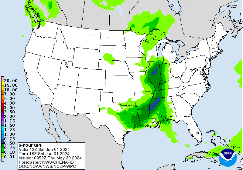
...Southeast Florida...
16Z Update: Little to no change to the previous MRGL risk
placement as convection billowing up along the sea breeze with
western cell motions could spur an isolated flash flood threat in
any urbanized settings in southeast FL. HREF probs continue to
depict modest 20-40% probabilities for local amounts greater than
5" with a higher confidence (60-80%) for greater than 3" over the
same area. Highest confidence in more appreciable totals continues
to be over central FL to the west of Lake Okeechobee, but those
areas tend to be much harder to flood considering very high FFG's
bordering 4-5" per hour necessary. Low probs for >3" per hour
allowed a continued nil in that area, but a non-zero chance is
forecast given the heavy rain anticipated. Will monitor for any
adjustments necessary as activity occurs.
Kleebauer
..Previous Discussion..
Afternoon convection expected to develop/increase across the middle
of the state south of Lake Okeechobee, then slowly drifting east
towards the urban corridor from West Palm Beach south, where any
isolated flash flooding threat exists. A small Marginal Risk area
was maintained.
Putnam/Campbell
Day 1 threat area:
www.wpc.ncep.noaa.gov/qpf/94epoints.txt
Excessive Rainfall Discussion
NWS Weather Prediction Center College Park MD
1153 AM EDT Fri Jul 3 2026
Day 2
Valid 12Z Sat Jul 04 2026 - 12Z Sun Jul 05 2026
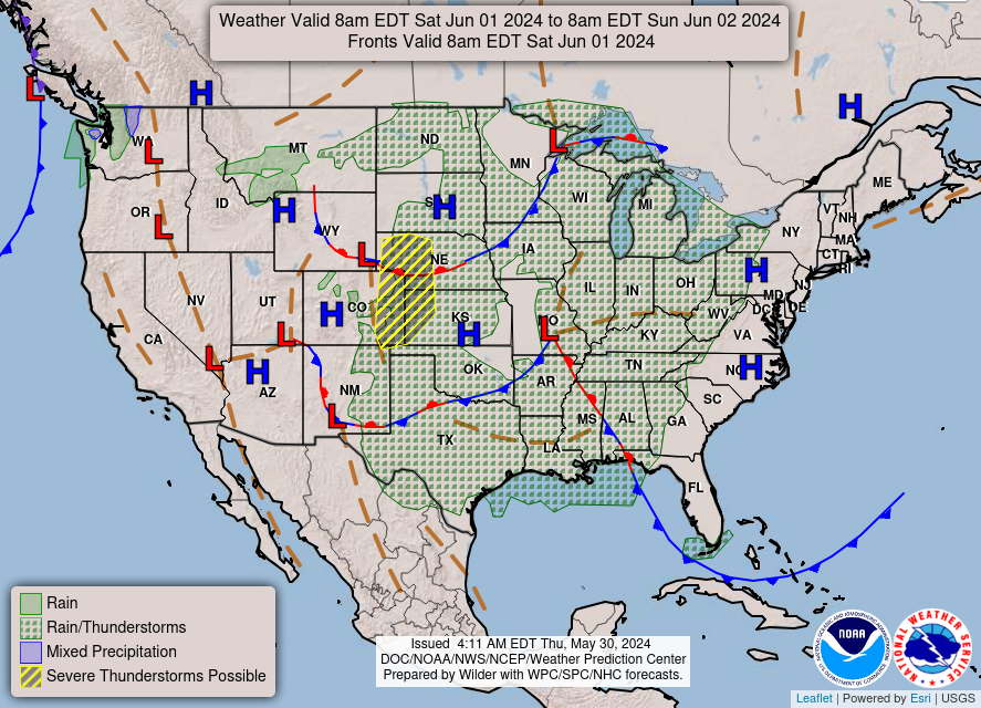
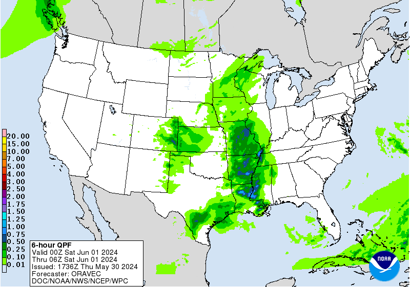
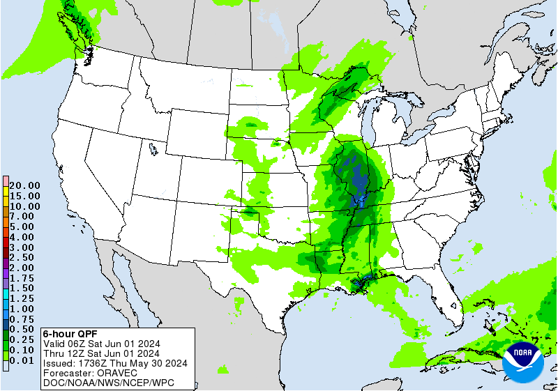
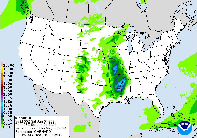
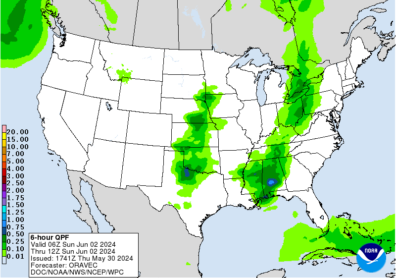
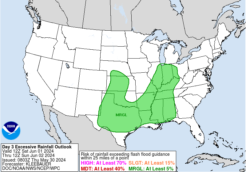
...THERE IS A MARGINAL RISK OF EXCESSIVE RAINFALL STRETCHING FROM
THE NORTHERN/CENTRAL PLAINS THROUGH THE MIDWEST, OHIO AND TENNESSEE
VALLEYS, AND MID-ATLANTIC...
With the upper ridge weakening, there will be at least an isolated
threat for excessive rainfall and flash flooding potential from the
Plains to the Mid-Atlantic region for this period. High moisture
and instability will remain in place along the northern side of the
ridge ,south of the frontal boundary, with at least scattered
thunderstorms likely with the daytime heating. The potential for
greater coverage of heavier rainfall, higher totals, and more
scattered instances of flash flooding is greatest over the
Northern/Central Plains into the Upper Midwest where embedded
upper-wave(s) will help to encourage more widespread thunderstorms
and the possibility of more organized convective systems.
Uncertainty remains on where the highest concentration of heavy
rainfall will materialize, hence the broad area with a Marginal
Risk for flash flooding. However, another MCS will likely
materialize along the Nebraska/Northeast Kansas/Northwestern
Missouri corridor Saturday night/overnight and will be progressive
in nature.
Putnam/Campbell
Day 2 threat area:
www.wpc.ncep.noaa.gov/qpf/98epoints.txt
Excessive Rainfall Discussion
NWS Weather Prediction Center College Park MD
1153 AM EDT Fri Jul 3 2026
Day 3
Valid 12Z Sun Jul 05 2026 - 12Z Mon Jul 06 2026
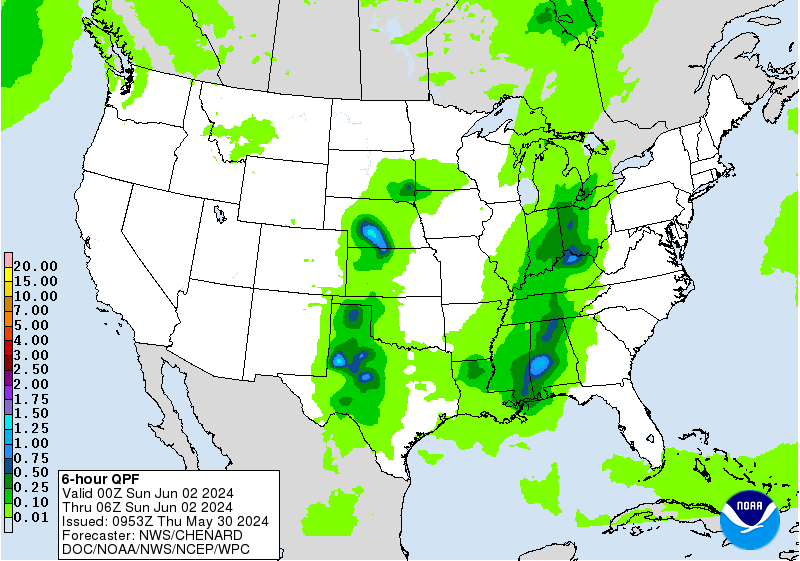
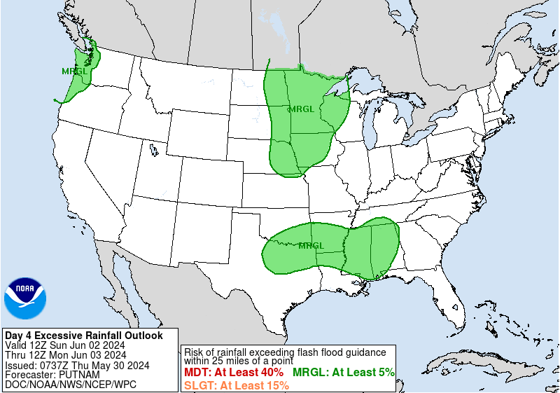
...THERE IS A SLIGHT RISK OF EXCESSIVE RAINFALL ACROSS PORTIONS OF
THE MID-ATLANTIC...
The pattern setting up during this period is favorable for heavy
rainfall, especially near the Appalachians and locations east
toward the Eastern Shore. A low to mid level trough interacting
with a backdoor front should provide a focus for heavy rainfall
and at least moderate levels of instability should overlap with
PWs over 2" across portions of the region. There will also be the
potential for training and backbuilding of convection as westerly
flow aligns with the boundary. A Slight Risk area covers most of
Pennsylvania, Maryland, northern Virginia, and portions of
Delaware and New Jersey. A broad Marginal Risk area spans from
eastern Oklahoma eastward to the Mid-Atlantic/southern portions of
the Northeast.
Campbell
Day 3 threat area:
www.wpc.ncep.noaa.gov/qpf/99epoints.txt


